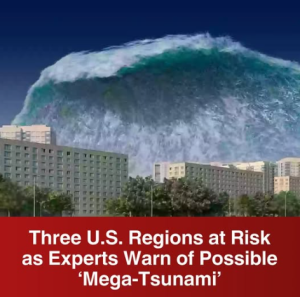
Experts Warn: Three U.S. Regions at Risk of Possible ‘Mega-Tsunami’
When most people think of natural disasters in the United States, images of hurricanes, wildfires, or tornadoes often come to mind. Yet, beneath the surface of the oceans and along the edges of the country’s coasts, scientists are keeping a close watch on another terrifying possibility: the mega-tsunami. Unlike smaller, more localized waves, a mega-tsunami can span hundreds of miles, obliterate coastal infrastructure, and displace millions within hours. Experts have identified three particularly vulnerable regions in the U.S. where this catastrophic event could occur, reminding Americans that the ocean’s power is both awe-inspiring and potentially devastating.
1. The Pacific Northwest – Cascadia Subduction Zone
The first and perhaps most widely discussed risk area is the Cascadia Subduction Zone, a fault line stretching roughly 600 miles from Northern California to British Columbia. Here, the Juan de Fuca tectonic plate pushes beneath the massive North American plate. While this slow-motion collision may seem invisible, the pressure it creates is extraordinary. According to geologists, the Cascadia Subduction Zone has the potential to unleash an earthquake as strong as magnitude 9.0 or higher.
What makes this particularly dangerous is the domino effect: such a quake would trigger a massive vertical displacement of the seafloor, displacing billions of gallons of seawater. That sudden push could launch a tsunami with waves towering over 100 feet in some places.
Researchers warn that if such an event occurs, it would devastate coastal cities including Seattle, Portland, and communities along Oregon’s rugged coast. Simulations suggest waves could reach inland several miles, swallowing entire neighborhoods and leaving little time for evacuation. Historically, the region has experienced such an event before; Japanese records document an “orphan tsunami” in 1700 that originated from Cascadia. The next one, scientists caution, is a matter of when, not if.
Emergency planners in Washington and Oregon are already preparing for this scenario, constructing vertical evacuation towers and running frequent drills. Still, experts emphasize that current evacuation routes may be insufficient to save everyone in low-lying areas.
2. Hawaii – Vulnerable From All Sides
The Hawaiian Islands, though breathtakingly beautiful, sit in one of the most tsunami-prone regions in the world. Because Hawaii lies in the central Pacific Ocean, it is vulnerable to tsunamis generated by seismic activity from nearly any direction—whether from Japan, Alaska, South America, or even undersea volcanic activity nearby.
But beyond the typical Pacific earthquakes, scientists also highlight the danger of volcanic flank collapses. Specifically, parts of Hawaii’s massive volcanic mountains, such as the Big Island’s Mauna Loa, could potentially break away in massive landslides into the ocean. Should a significant portion of the volcano collapse suddenly into the sea, the resulting displacement of water could trigger a mega-tsunami with waves over 1,000 feet high, racing outward across the Pacific basin.
Though such events are rare and debated in terms of likelihood, geological evidence shows they have happened before. Deposits found on the ocean floor and unusual boulder placements high on Hawaiian cliffs suggest ancient waves of unimaginable size once crashed upon the islands.
Today, Hawaii maintains one of the most sophisticated tsunami warning systems in the world, with sirens, broadcast alerts, and evacuation maps. However, in the case of a sudden volcanic collapse, warning times could be measured in mere minutes rather than hours, leaving residents and tourists with almost no time to react.
3. The U.S. East Coast – Canary Islands Threat
Unlike the Pacific and Hawaii, the Atlantic Ocean is not typically associated with massive tsunamis. Yet scientists warn that one particular location thousands of miles away could still place America’s East Coast at risk: the volcanic Canary Islands, off the northwest coast of Africa.
Specifically, the Cumbre Vieja volcano on La Palma Island has long worried geologists. If a major eruption were to cause part of the volcano’s western flank to collapse into the Atlantic, it could displace enough water to send a series of colossal waves surging westward. Models suggest that such a landslide could generate waves more than 150 feet high upon impact with the U.S. coastline, traveling thousands of miles across the Atlantic.
The areas most at risk would include Florida, the Carolinas, New York City, and even parts of New England. Given the dense population of the East Coast, the damage and loss of life could be catastrophic. Unlike local tsunamis, however, an event originating in the Canary Islands might allow several hours of warning. Yet, mass evacuations of major metropolitan areas like New York or Miami within that timeframe would be extraordinarily challenging.
Why Experts Are Sounding the Alarm
While the probability of any one of these mega-tsunami scenarios occurring in the near future is relatively low, scientists stress the importance of preparation because the consequences would be beyond catastrophic. Modern technology, dense coastal populations, and interconnected economies mean that a single event could cause trillions in damages and leave millions homeless.
Several factors drive experts’ concerns today:
-
Urbanization of coastlines – More Americans than ever live in coastal areas, from Florida’s booming cities to the Pacific Northwest’s hubs. More people means more potential victims.
-
Climate change and sea level rise – Higher sea levels make tsunamis more destructive, even if the waves themselves are not record-breaking.
-
Complacency – Many communities do not regularly practice tsunami drills or maintain adequate evacuation infrastructure.
For example, while Japan’s 2011 tsunami demonstrated the devastating force of nature, it also revealed that preparation saves lives. In regions where evacuation routes were well marked and practiced, more people survived. The U.S., experts argue, must learn from these lessons before it is too late.
What Can Be Done?
To minimize the impact of a potential mega-tsunami, experts recommend a combination of technological, infrastructural, and cultural changes:
-
Improved monitoring: Seafloor sensors, GPS networks, and early-warning systems must continue to be funded and expanded.
-
Public education: Schools, businesses, and tourism hubs should regularly educate people on how to respond to a tsunami alert.
-
Evacuation planning: High-risk areas need vertical evacuation structures, elevated safe zones, and realistic drills.
-
International cooperation: Since tsunamis cross oceans, data-sharing between nations is critical for early detection.
The U.S. has already made progress in these areas, but experts warn that complacency is dangerous. Just because the last mega-tsunami in these regions happened hundreds or even thousands of years ago does not mean another cannot occur soon.
Final Thoughts
Mega-tsunamis remain among the most frightening natural disasters imaginable. They strike suddenly, move at terrifying speeds, and leave devastation in their wake. For the United States, three regions—the Pacific Northwest, Hawaii, and the East Coast via the Canary Islands—stand out as particularly vulnerable.
While the likelihood of such an event in any given year remains low, the potential cost of ignoring the risk is unthinkable. As scientists emphasize, the key is not to live in fear, but to live prepared. History has shown that the ocean is capable of reshaping entire coastlines in an instant. The only question is whether communities will be ready when it happens again.