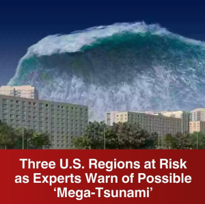
Experts Warn: Three U.S. Regions at Risk of Possible ‘Mega-Tsunami’
A chilling warning has been issued by geologists and oceanographers as new research reveals that three distinct regions in the United States could be vulnerable to what scientists are calling a “mega-tsunami” — a colossal wave event capable of leveling entire coastal cities, displacing millions, and leaving widespread devastation in its wake. While the term may sound sensational, the science behind it is sobering, and the risks are real.
What Is a Mega-Tsunami?
Unlike regular tsunamis that result from distant underwater earthquakes and usually cause waves a few meters high, a mega-tsunami is triggered by a massive and sudden displacement of water, often from a landslide, volcanic eruption, or even an asteroid impact. These waves can reach heights of 100 feet or more, racing across oceans at hundreds of miles per hour and wiping out coastlines with little warning.
Though rare, mega-tsunamis have occurred in the past — most notably in Lituya Bay, Alaska in 1958, when a landslide triggered a wave estimated at 1,720 feet tall. Fortunately, that event occurred in a remote region. But experts now warn that such destructive forces could threaten densely populated coastal zones.
The Three U.S. Regions Most at Risk
1. Pacific Northwest – Cascadia Subduction Zone
The Cascadia Subduction Zone, stretching from northern California to British Columbia, is one of the most dangerous fault lines in North America. Here, the Juan de Fuca Plate is slowly sliding under the North American Plate, building tension that scientists say is overdue to release in a massive earthquake — potentially a magnitude 9.0 or higher.
But what many don’t realize is that this quake could trigger a tsunami of catastrophic scale. According to FEMA and NOAA simulations, a wave generated by a rupture along this fault could reach the Oregon and Washington coasts within 15–20 minutes of the quake, leaving very little time for evacuation.
“We’re not just talking about flooding here,” said seismologist Dr. Jennifer Gallagher. “We’re talking about entire coastal communities being wiped out. The infrastructure isn’t ready, and the public isn’t fully aware.”
Communities like Seaside, Oregon, and Long Beach, Washington could be among the hardest hit, with models predicting waves up to 100 feet in some areas. Many public schools, hospitals, and retirement communities lie within tsunami inundation zones.
2. La Palma, Canary Islands – Atlantic Coast Threat
While not located within U.S. territory, the Cumbre Vieja volcano on the island of La Palma in the Canary Islands poses a remote but deeply concerning threat to the U.S. East Coast. Scientists have long warned that a major eruption could send part of the island’s western flank crashing into the Atlantic Ocean, displacing enough water to trigger a transatlantic mega-tsunami.
If this landslide occurs — and some believe it is only a matter of time — a massive wall of water could travel across the ocean, reaching the East Coast of the U.S. in around 8–9 hours. Cities such as Miami, New York, Boston, and Charleston could see waves ranging from 30 to 60 feet high, depending on topography and proximity to the coastline.
“This is not science fiction,” warned Dr. Ethan Morales, a tsunami modeling expert at Columbia University. “The geological structure of Cumbre Vieja is unstable. A major eruption or seismic event could tip the balance.”
While the likelihood of this event happening soon remains low, the consequences would be devastating. Much of the East Coast lacks the type of tsunami preparedness infrastructure seen in places like Japan or Hawaii.
3. Alaska’s Glacier Bays – Climate-Triggered Landslides
The third region under intense scrutiny is southern Alaska, particularly its glacier-carved fjords and bays, where rapid glacial melting due to climate change is weakening mountainsides at an alarming rate.
In 2020, scientists discovered several slopes near Barry Arm Fjord showing signs of instability. One particular slope could release millions of cubic meters of rock into the water below if it collapses — potentially creating a tsunami up to 300 feet high locally and sending waves down the Pacific coast.
“This is one of the most immediate threats we’ve identified,” said Dr. Anna Larsen of the U.S. Geological Survey. “It’s a perfect storm: climate change is accelerating ice loss, which is destabilizing steep cliffs. The rock doesn’t need much encouragement to fall.”
Communities near Prince William Sound — such as Whittier and Valdez — could be devastated. Even cruise ships traveling through the region would have little warning if a massive landslide occurred. Alaskan authorities have started monitoring the slopes more closely, but the remote nature of these areas makes response time limited.
The Growing Urgency for Preparedness
Across all three regions, scientists emphasize that while the risk may not be imminent in the next year, it is not far off in geological terms — and growing factors such as climate change, urban sprawl, and aging infrastructure increase the danger.
“We are woefully underprepared,” said coastal engineer Maya Singh. “In some places, there are no working tsunami sirens. In others, evacuation routes are poorly marked or don’t exist. It’s not a matter of if, it’s a matter of when.”
What Can Be Done?
Preparedness is key to reducing the impact of these potential disasters:
-
Early Warning Systems: Investment in sea-floor sensors, satellite monitoring, and emergency broadcast systems can buy precious minutes or hours.
-
Public Education: People in high-risk zones must be trained to recognize the signs of an impending tsunami — such as a sudden withdrawal of water from the beach or a strong coastal quake.
-
Land Use Planning: Communities must consider moving critical infrastructure inland and out of tsunami zones.
-
Drills and Evacuation Plans: Regular community-wide drills can save lives. Schools, hospitals, and nursing homes must have clear evacuation strategies.
Final Thoughts
The idea of a mega-tsunami may seem like something out of a disaster movie, but scientists warn that the threat is grounded in hard data. From fault lines poised to rupture to unstable volcanic slopes and climate-induced landslides, multiple regions in and near the U.S. are ticking time bombs for large-scale wave disasters.
“This isn’t about panic,” said Dr. Morales. “It’s about being proactive. We have the knowledge. Now we need the political and public will to act on it — before it’s too late.”